A magnitude 7.8 earthquake struck Mindanao on Monday morning, June 8, with its epicenter located 32 kilometers west of Maasim, Sarangani, at a depth of 33 kilometers, according to the Philippine Institute of Volcanology and Seismology (Phivolcs).
By 8 p.m., the death toll had climbed to more than 30, with authorities reporting 17 fatalities in Sarangani, 12 in General Santos City, and two in South Cotabato.
The Office of Civil Defense (OCD) said damage assessments and retrieval operations were ongoing to determine the full extent of the disaster.
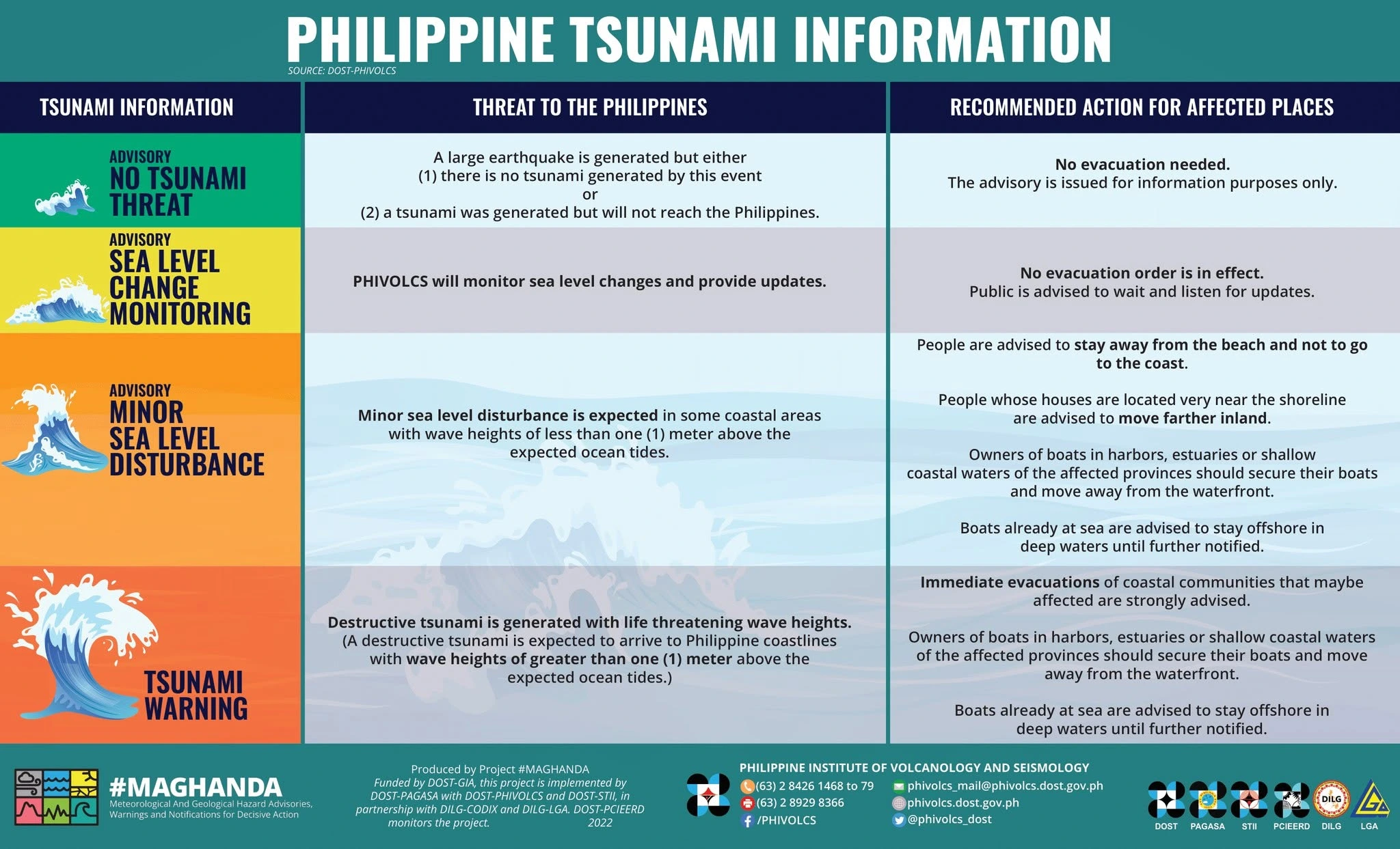
As residents grapple with the devastation, many are asking why the earthquake was so powerful and why a tsunami warning was immediately issued.
Read also: Classes back in CDO; suspension status varies across Normin
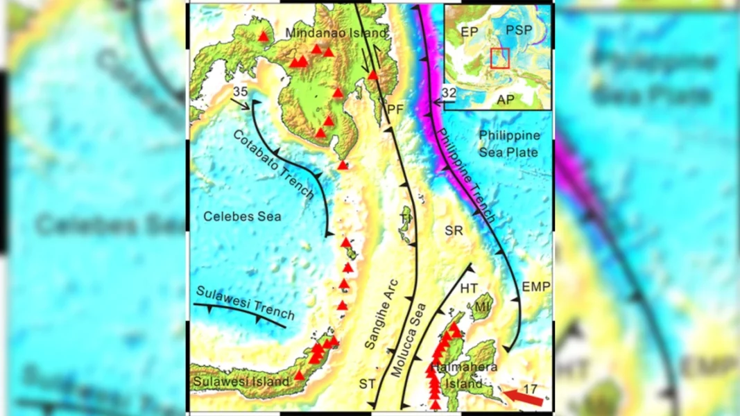
The answer lies beneath the sea floor along the Cotabato Trench, one of the country's most active tectonic zones.
A subduction zone forms when one tectonic plate slides beneath another.
This geological process creates deep ocean trenches and can generate powerful earthquakes capable of displacing large volumes of seawater, triggering tsunamis.
Because the earthquake occurred near the Cotabato Trench, authorities quickly issued tsunami warnings for several coastal areas in Mindanao, including Davao Occidental, Tawi-Tawi, Sulu, and Zamboanga del Sur.
The Cotabato Trench lies along the western and southwestern boundaries of the Philippine Mobile Belt, where several major tectonic plates—including the Eurasian, Indo-Australian, Pacific, and Philippine Sea plates—interact.
You may also like: Aftershocks loom: What residents should do
These complex plate movements make the region highly susceptible to strong earthquakes.
The trench is also linked to the tectonically active Mindanao-Molucca region, considered one of Southeast Asia's most complex geological areas.
Scientists have long monitored the region because of its interconnected subduction zones and active faults.
Studies have shown that both the Cotabato Trench and the Philippine Trench remain active sources of seismic activity.
Research based on data from the International Seismological Centre indicates that earthquakes occurring at depths of up to 40 kilometers are associated with ongoing subduction processes in the area.
The Cotabato Trench has a long history of generating destructive earthquakes. It was the source of the magnitude 7.9 Moro Gulf earthquake in 1976, one of the deadliest natural disasters in Philippine history, which triggered a devastating tsunami and claimed thousands of lives.
Nearly five decades later, the trench remains a major source of seismic risk, serving as a reminder of the need for earthquake preparedness and tsunami awareness in vulnerable coastal communities.