By NITZ ARANCON
Correspondent
ANOTHER tropical threat is threatening lives and property again.
The potential storm, brewing over the Pacific Ocean near Palau, could bring heavy rains on New Year’s Day or this weekend, according to the Philippine Atmospheric, Geophysical and Astronomical Services Administration.
Like tropical storm “Vinta” that formed near Palau last week, the weather system is also tracking towards the Visayas but even then, it would likely bring heavy rains in northern Mindanao.
Pagasa weather specialist Luz Mercado yesterday said the weather system’s cloud formation is threatening. It could also intensify into a low pressure area and pick up more strength and become a tropical depression as it enters Philippine territory this weekend.
“Tu-a pa man siya sa dagat, makakuha pa siyag dugang strength, mao nga dako gyud ang posibilidad nga pagsulod niini nga weather disturbance sa Pilipinas, mahimo siyang low pressure area,” Mercado said.
She said Pagasa expects the tropical threat to bring heavy rains in northern Mindanao this weekend or even on New Year’s Day. “Dili gihapon ta makalikay sa kusog nga mga pag-ulan dinhi sa northern Mindanao sa weekend o New Year’s Day kay dako man kaayo ang iyang cloud band.”
If it turns into a storm over Philippine territory on New Year’s Day, Pagasa would call the storm “Agaton” but if it comes on Sunday or earlier, it would be named “Wilma,” the 23rd storm to hit the country this year, Mercado said.
US-based commercial weather forecasting service provider Accuweather has warned about the new tropical threat as early as Wednesday. It gave a fairly accurate forecast on the strength and track of storm “Vinta” days before it made landfall in Davao Oriental last week ahead of Pagasa.
In a Dec. 27 forecast, Accuweather meteorologist Eric Leister warned: “Development is possible as early as Friday near Palau, and a general westward track will take the potential cyclone toward the southern Philippines.
“The threat for heavy rainfall capable of producing flooding and mudslides will return to southern Visayas and Mindanao as early as Sunday night, with more significant impacts expected on Monday and Tuesday.
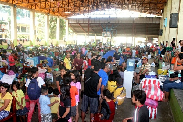
“These areas have already endured widespread flooding and damaging mudslides that have caused travel chaos and damaged more than 10,000 homes.
“New rainfall amounts of 100-200 mm (4-8 inches) are possible, with local amounts exceeding 300 mm (12 inches)….”
Disclaimer
Mindanao Gold Star Daily holds the copyrights of all articles and photos in perpetuity. Any unauthorized reproduction in any platform, electronic and hardcopy, shall be liable for copyright infringement under the Intellectual Property Rights Law of the Philippines.


